
The operational problem
On a long flight, the aircraft moves through latitude, longitude, altitude, and multiple time zones while the sun’s position changes continuously.
A single-location solar calculator requires the pilot to repeat the calculation for different waypoints. About Flying instead uses route or waypoint inputs to sequence the airports and waypoints along the planned routing.
This tool is designed for pilots who want a practical estimate of the sequence and timing of light events during a planned flight.
Inputs and output
Enter the route or waypoint information, flight timing, and relevant altitude inputs available for the planned sector. About Flying calculates an altitude-adjusted UTC timeline for applicable solar events.
- Dawn, sunrise, sunset, dusk, and twilight estimates
- Route or waypoint calculation workflows
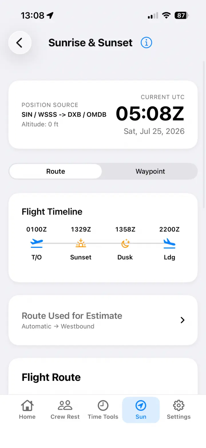
- A flight timeline showing the expected order of events
Why offline use matters
The calculation runs on the iPhone without an account or calculation server. A pilot can prepare the estimate before departure and revisit it in flight without relying on connectivity.
Example workflow
For a Singapore-to-Dubai sector, the pilot enters the planned route or representative waypoints, the flight times, and altitude. About Flying then shows whether dawn, sunrise, sunset, dusk, or twilight is expected along the flight and places those events in sequence on a UTC timeline.
Important limitations
Results are estimates based on the route, waypoints, timing, altitude, and assumptions entered. Actual routing, speed, weather, terrain, horizon, atmospheric conditions, and operational changes can affect what is observed. The tool is not a navigation, weather, dispatch, or certified flight-planning system; verify operational decisions using current approved sources.
Flight sunlight calculator FAQ
Does it calculate more than sunrise and sunset?
Yes. The workflow supports twilight estimates in addition to sunrise and sunset.
Is it accurate?
Results are estimates. For the best estimate, pilots can enter the nearest airports or representative waypoints along their planned route. About Flying automatically sequences the waypoints, but important results should still be checked against approved operational sources.
Can it use waypoints?
Yes. Pilots can use route or waypoint inputs to represent the planned flight path.
Are the results official flight-planning data?
No. They are planning estimates and must not replace current company, dispatch, navigation, weather, or regulatory information.